New York State Secretary of State Applications for Land Grants
Records within this series include affidavits or certificates of military service submitted by veterans, as well as surveys of the land they were given.
The series, State Applications for Land Grants, was created under direction of Secretary of State John Van Ness Yates in 1819 from an amalgam of documents taken from the "Colonial Council Papers," the "Papers of the Land Office," and several other small series that existed in the office at that time.
The selected records below consist of applications and related papers of soldiers and officers eligible for land grants after demobilization in 1763, documenting military service and colonial settlement leading up to the American Revolution.
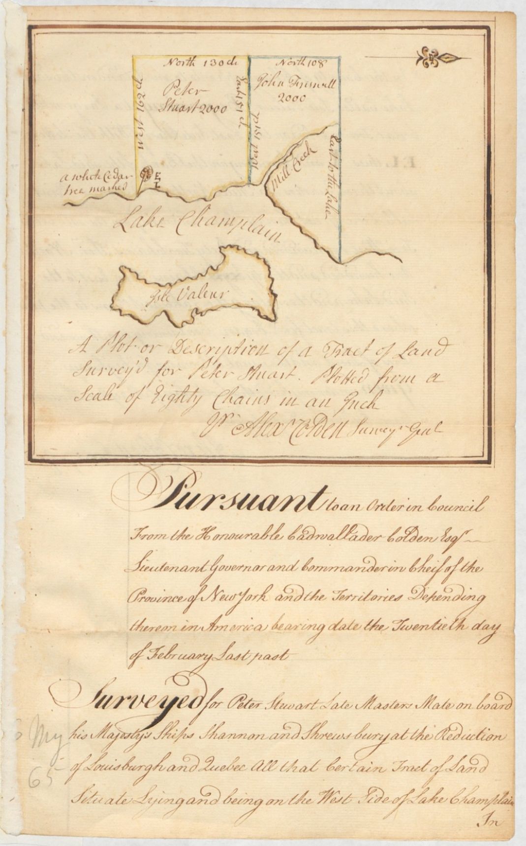
Return of survey for Peter Stewart
Identifier
NYSA_A0272-78_V18_p172_s1
Description
Return of survey for Peter Stewart, late master’s mate on board H. M.’s ships Shannon and Shrewsbury, at the reduction of Louisburgh and Quebec, of a tract of 2,000 acres of land on the west side of Lake Champlain, in the county of Albany, opposite Isle Valcour, (Peru, Clinton Co.), May 6, 1765. Just over a decade after this tract was surveyed, on October 11, 1776, this area would be the site of a naval battle between a British fleet and the fledgling Continental Navy under the command of Benedict Arnold
New York State Archives. New York (State). Secretary of State. Applications for Land Grants. A0272-78.
New York State Archives


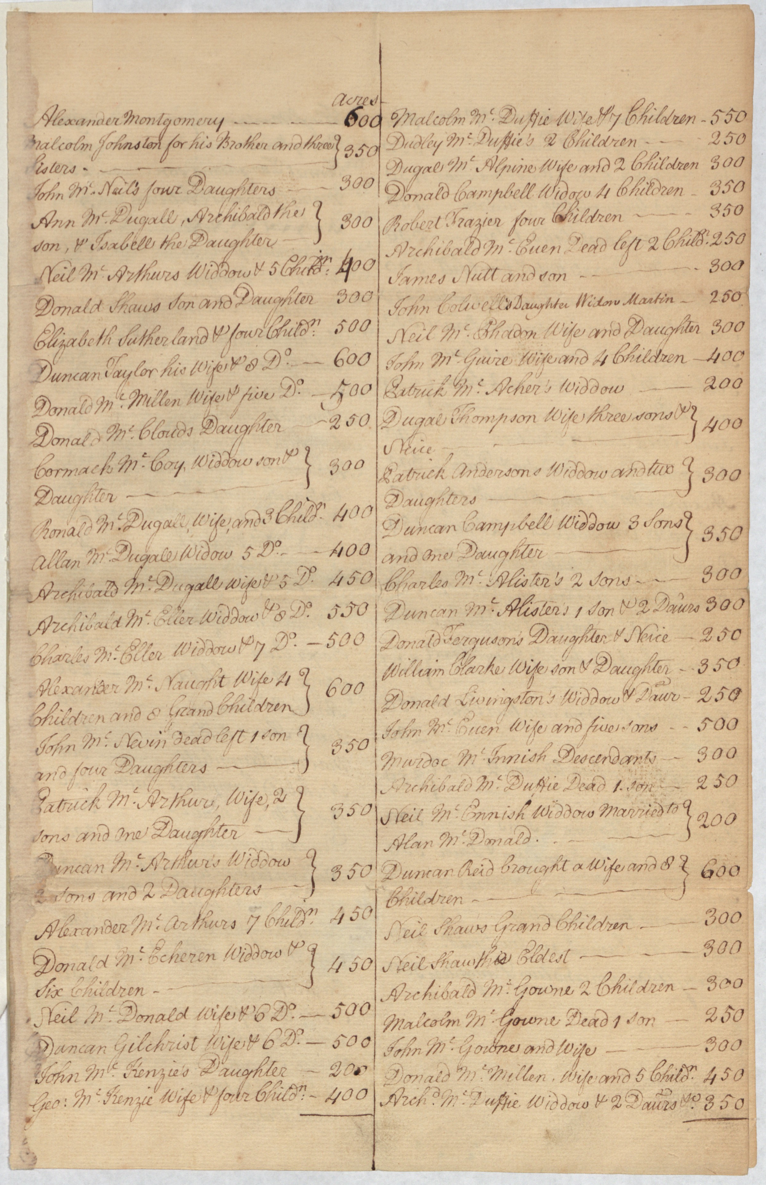
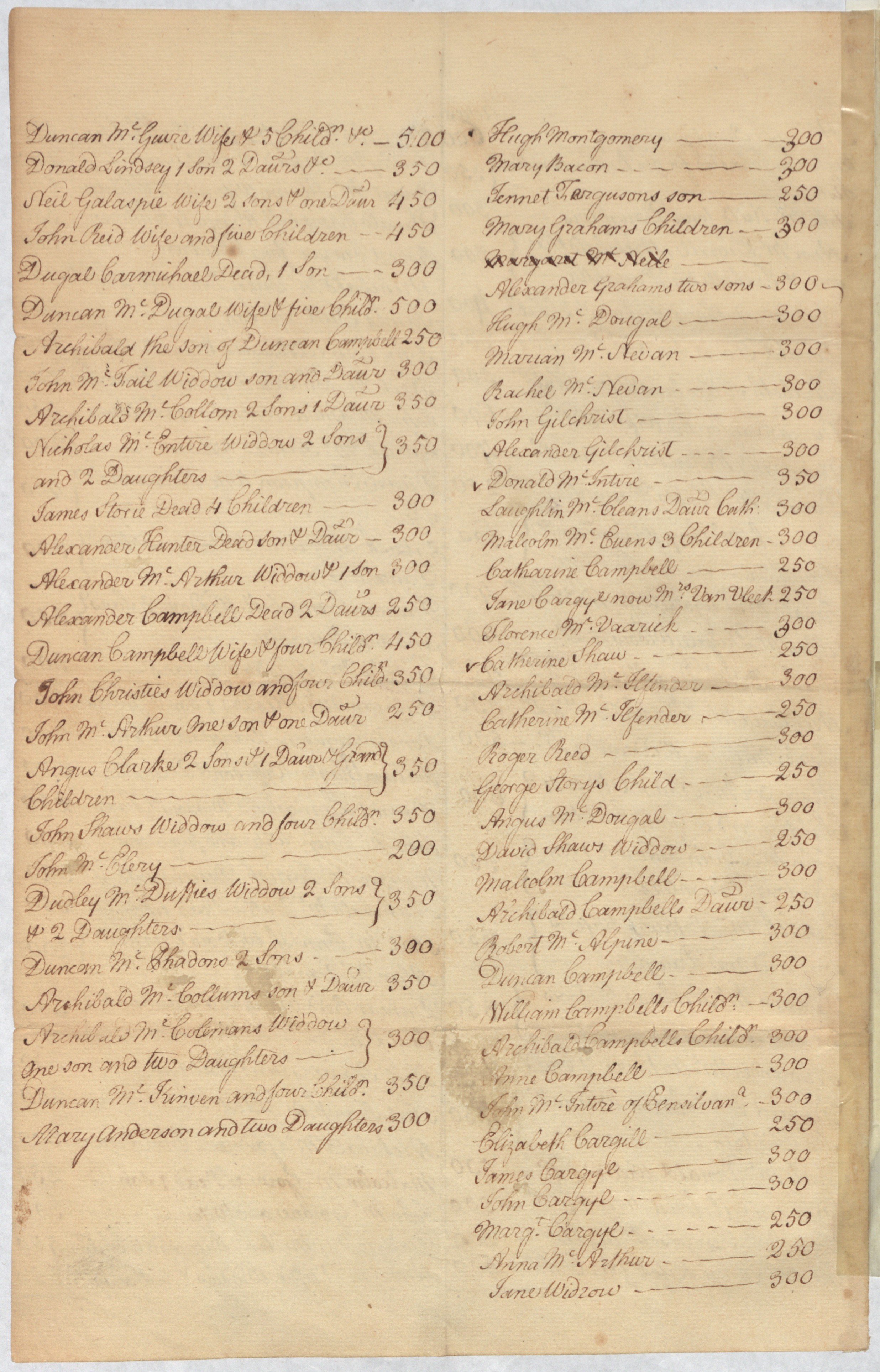
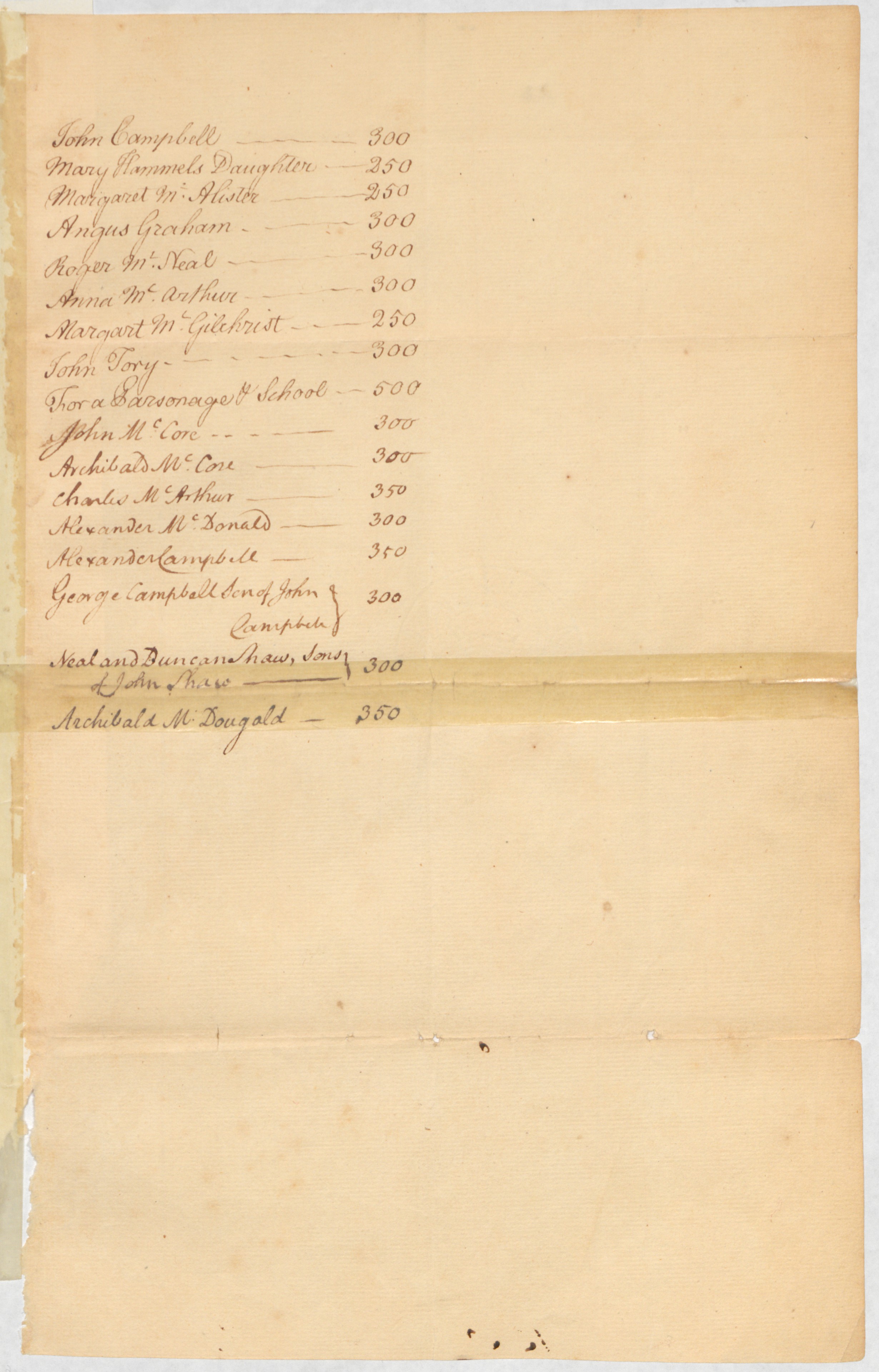
Schedule of names
Identifier
NYSA_A0272-78_V17_p063_s1-3
Description
Schedule of names, with the number of acres to each grantee, respectively, in the Argyle patent, c. 1764.
New York State Archives. New York (State). Secretary of State. Applications for Land Grants. A0272-78.
New York State Archives
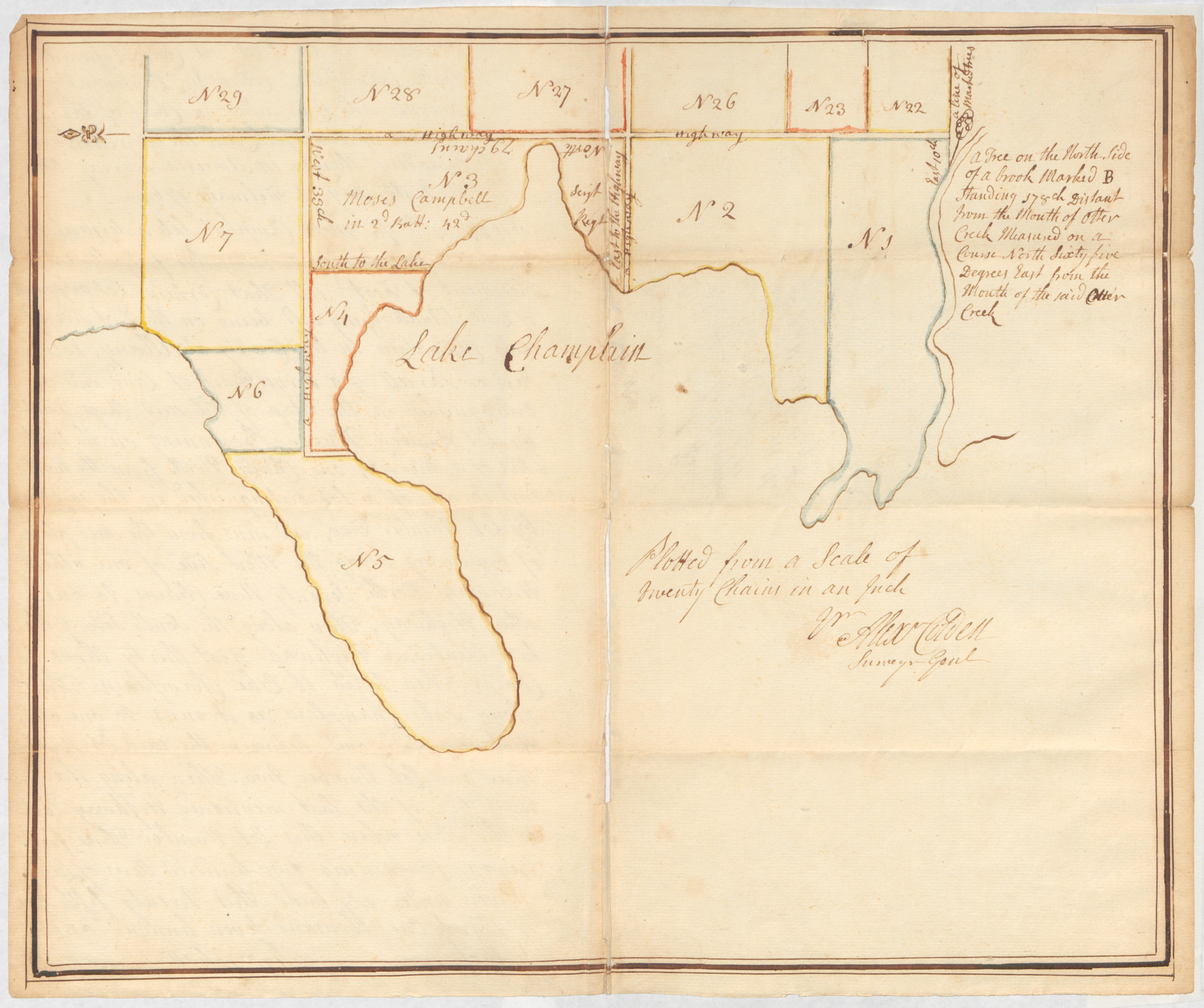
Map included with the return of survey for Moses Campbell
Identifier
NYSA_A0272-78_V18_p149_s2
Description
Map included with the return of survey for Moses Campbell, late serjeant in the 42nd Regiment, of 200 acres of land, on the east side of Lake Champlain, in the county of Albany, (Charlotte, Vermont), March 25th, 1765.
New York State Archives. New York (State). Secretary of State. Applications for Land Grants. A0272-78.
New York State Archives
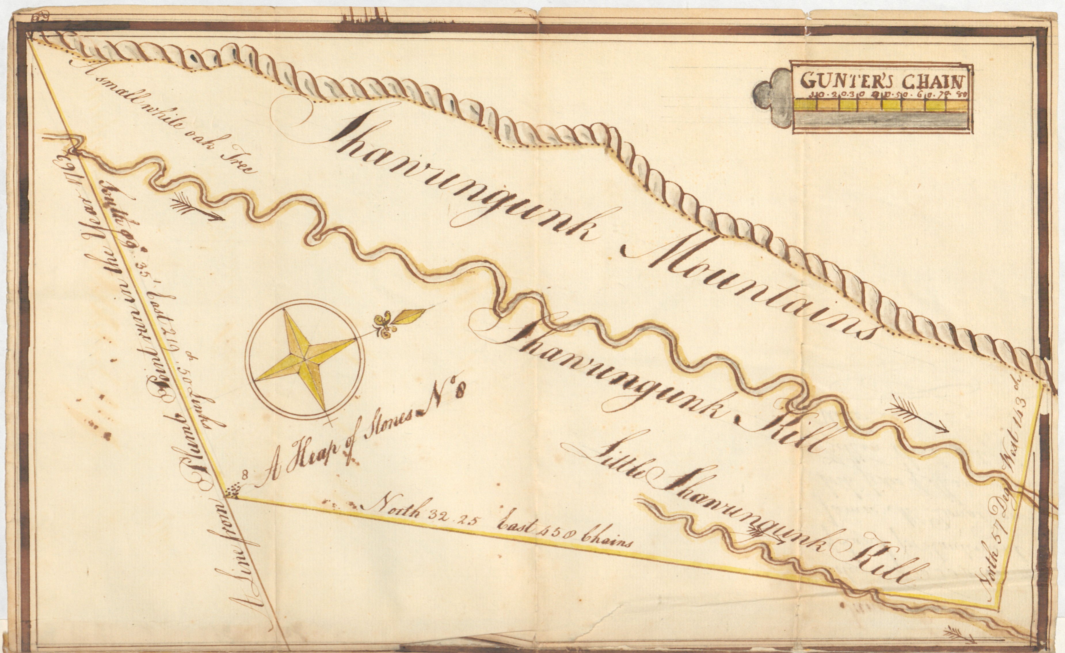
Map included with return of survey for James McDonald
Identifier
NYSA_A0272-78_V19_p078a_s3
Description
Map included with return of survey for James McDonald, late Lieut. in the 60th regiment, of a tract of 10,000 acres of land, in the county of Ulster, on both sides of the Shawangunk kill, (Calhoun, Orange Co.), June 29th, 1765.
New York State Archives. New York (State). Secretary of State. Applications for Land Grants. A0272-78.
New York State Archives
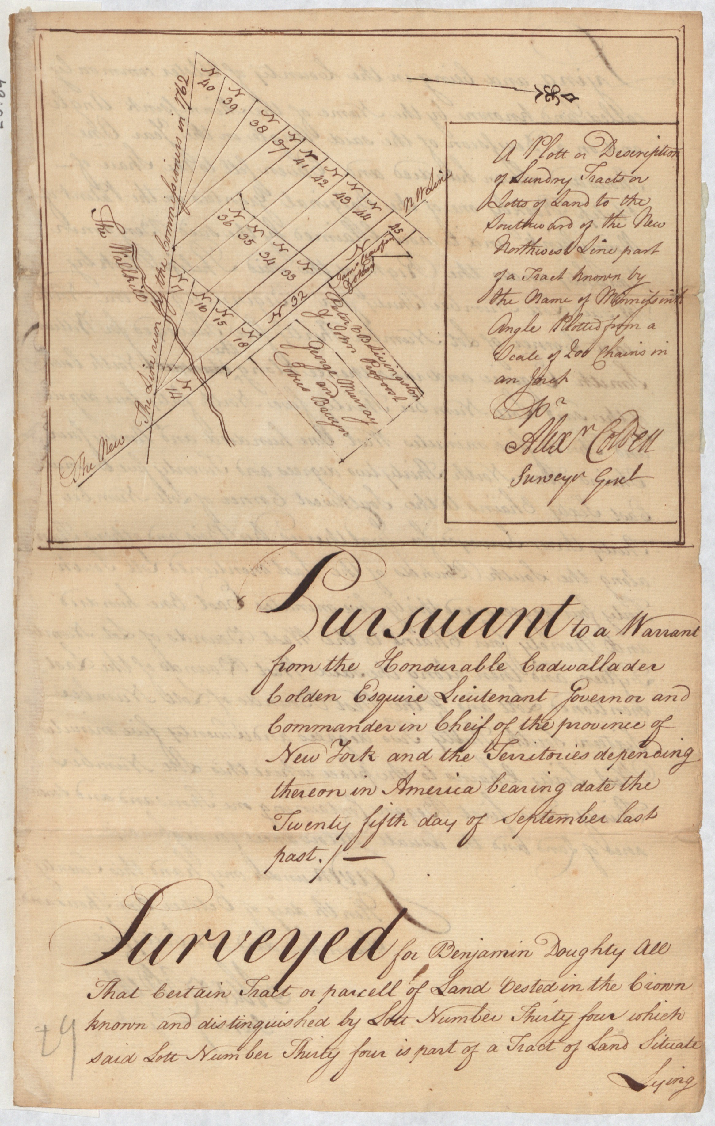
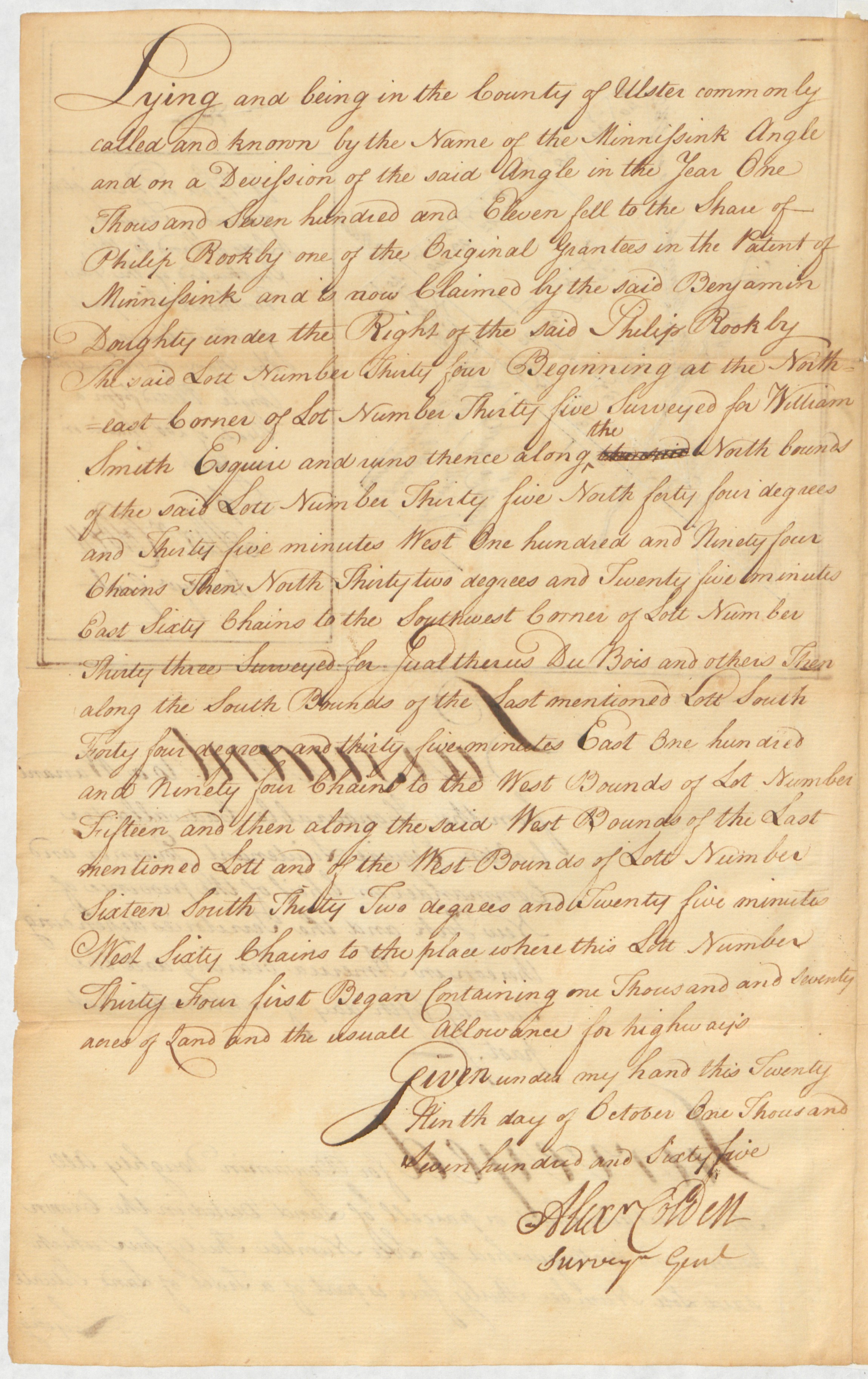
Return of survey for Benjamin Doughty
Identifier
NYSA_A0272-78_V20_p084_s1
Description
Return of survey for Benjamin Doughty, of a tract of 1,070 acres of land, in the county of Ulster, being lot 34 in the Minisink angle, (Calhoun, Orange Co.) with map of the same, October 29th, 1765.
New York State Archives. New York (State). Secretary of State. Applications for Land Grants. A0272-78.
New York State Archives
